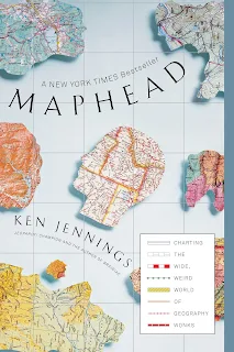
Maps are such a big part of our lives, I'm surprised I haven't read into the topic before now. I'm old enough to remember planning a journey with a road atlas or referring to handwritten directions, but I look at maps far more often now with GPS and Google Maps than I ever did before. In Maphead - Charting the Wide, Weird World of Geography Wonks, Ken Jennings is the ultimate tour guide.
Early on, he starts with some basics about different kinds of maps, like this one:
"Hypsometric maps are those ones that represent terrain with vivid colours: greens for low elevations, browns and purples for high ones.
I preferred the clean political maps that Hammond and National Geographic published, where cities and towns stood out neatly on lightly shaded territory and borders were delineated in crisp pastels. In fact, I dislike hypsometric maps to this day." Page 6I wasn't a fan of hypsometric maps when I was in Defence standing in the bush with a compass in my hand, but I do love an informative choropleth map, especially during elections:
"'Choropleth' maps - those in which areas are colored differently to represent different values on some scale, like the red-and-blue maps on election night - date back only to 1826." Page 8Jennings is the knowledgeable navigator in the passenger seat on this journey, and as you drive through the pages and chapters, he readily provides all manner of info about geonerds and their love of maps. If you enjoy learning quirky facts in quick succession, this is for you. Example, did you know that 'cartacacoethes' is the uncontrollable compulsion to see maps everywhere?
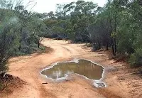
The puddle that looks like a perfect map of Australia immediately springs to mind, as does my remark last night that the protein (pork schnitzel) looked like the shape of Africa.
When the allies were planning the 1944 invasion at Normandy, there were extraordinary contributions made my mapmakers who had stolen across the English Channel by night for many months to map the coastline. Furthermore:
"In 1942, the BBC asked its listeners to send in prewar postcards and holiday snaps from the beaches of Europe. Seven million poured in, showing coastlines from Norway to the Pyrenees, and they were used to select Normandy as the site of the initial landing." Page 59Despite a reasonable knowledge of military history, this was completely new to me. It seems unheard of, until you remember a similar call out by more recent governments: 'if you see something say something' and the images submitted post 9/11.
I was happy to see Humpty Doo (Northern Territory) get a mention in the section about place names and toponymists, as the author tells us he's been an enthusisastic toponymist - a student of place-names - for as long as he's loved maps. We then move on to the market for collectors of ancient maps and globes for display purposes that stretches as far back as the Renaissance:
"This was a watershed moment in the history of cartophilia. For thousands of years, people had drawn maps because they had to: to get from one place to another, or locate taxpayers, or mark the boundaries of fields and pastures. If not for those maps, lives or property would be lost, governments might fall. But here, for the first time, we have evidence of people keeping maps just because they liked looking at them." Page 99Here Jennings mentions several figures from history - like John Dee, Samuel Pepys - who loved collecting and viewing maps, including Vermeer who reproduced maps in the backgrounds of more than a quarter of his paintings.
For readers who would rather leave history in the past, the section on maps in fantasy fiction was illuminating. C.S. Lewis, Tolkien, David Eddings are mentioned, but it was the detail about Brandon Sanderson's maps that held my attention the longest. The author and Sanderson were college roommates, so he offers quite an insight.
"The hallmark of epic fantasy is immersion," says the best-selling genre writer Brandon Sanderson. "That's why I've always included maps in my books. I believe the map prepares your mind to experience the wonder, to say, 'I am going to a new place.'" Page 113Jennings weighs in on the 'map gap' between the genders, and he made some convincing arguments:
"Tests on gender and navigation have found that women tend to navigate via landmarks ("I turn left when I get to the gas station") whereas men use dead reckoning ("I still need to be north and maybe a little west of here"), which ties in nicely with the evolutionary perspective: early men went out on hunting expeditions in all directions and always needed to be good at finding their way back to the cave, developing their "kinesic memory," while women foraged for edibles closer to home, developing "object location memory." Simply put, men got better at finding places, while women got better at finding things." Page 139-140I'm also guilty of setting my map preference to 'forward is up', while my husband prefers the 'north is up' orientation which totally messes with my mind when I'm forced to use it.
The section on systematic travel was fascinating, and the first person who came to mind was Matt Harding, whose Where the Hell is Matt? series went viral in the 2000s. Some systematic travellers aim to visit every country in the world, perhaps every capital city, every state in the USA, the most northern/southern/eastern/western tip of a landmass. But how about ticking off the junction of state borders, or the highest mountains on every continent? The sky is the limit, and while I think I'd find the concept stressful, ticking off locations is high on the list for systematic travellers.
Just like twitchers and trainspotters, roadgeeks are the highway scholars of mapheads, and take photos of road signs to clock their routes.
"They can tell the difference between a Westinghouse streetlight and a GE one and are the only ones who notice when the lettering on interstate signage is switched over from Highway Gothic to the new Clearview font." Page 167I don't know why, but I find this incredibly reassuring and even comforting. Perhaps knowing there are people in the world who pursue these particular interests gives me a sense that in every field, no matter how specialised, there is an expert; someone who lives and breathes everything there is to know about that topic.
The chapter on geocaching had me checking for geocache locations near me and - just like the author - I was surprised to find one less than 500m from my front door! It only required a photograph to complete the find, so I wasn't tempted to sign up and start checking caches on the weekend, but I'll certainly look twice next time I see someone taking a selfie at that location. They could be a geocacher!
Maphead by Ken Jennings is endlessly fascinating, and while I've been lucky enough to experience the thrill of watching the numbers tick over on the GPS when crossing the equator, did you know that confluence hunting is a thing?
"The Degree Confluence Project was started in 1996 by a Massachusetts Web programmer named Alex Jarrett, a new GPS owner who noticed that his commute happened to take him across the nearby seventy-second meridian twice a day." Page 237Jennings tells us that no spot on Earth is more than 49 miles from one of these points of 'cartographic perfection' and there are 16,340 confluence points worldwide. Can you imagine? Maybe you've been lucky enough to visit a location (US has a few) where you can stand right at the spot where 3 or 4 states come together. Perhaps you just give a hoot when you cross from NSW to VIC in your car, but for a confluence hunter this is small fry.
I can see this review is getting long, and I haven't even begun to touch on all of the Google Earth and street view stuff! In reading Maphead and learning why so many people are cartographically cloddish, I'm convinced Geography needs to re-enter the curriculum of the day.
If you suspect you'll need to look up images of maps while reading this, you're spot on, so have your device at the ready. Maphead - Charting the Wide, Weird World of Geography Wonks by Ken Jennings is an absolutely fascinating read and I'll be sorry to return it to the library.
Highly recommended!


